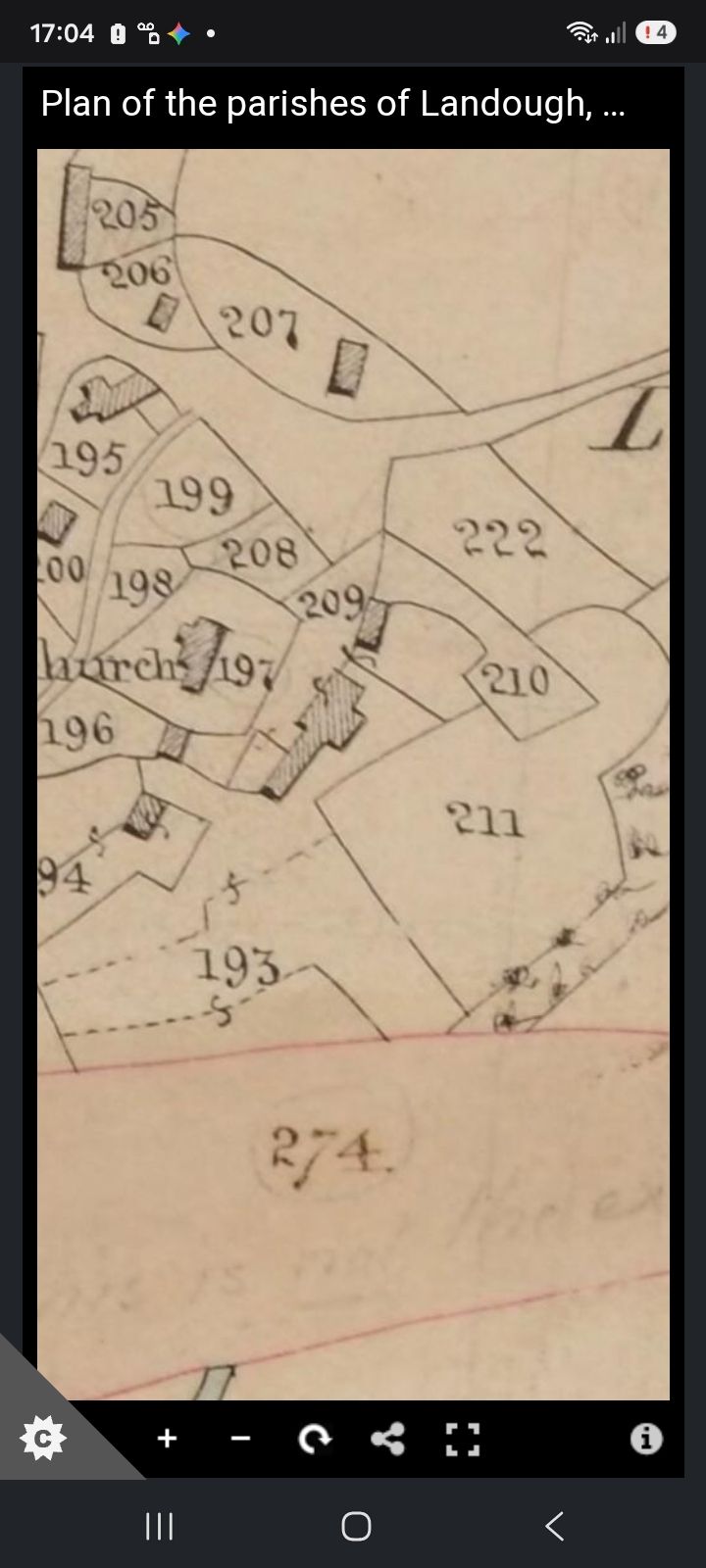
GHF-E165 — Historical map labelled “1841-map” (original image upload)
Wiki catalogue reference: GHF-E165 · Custodian / source URL: Buckler family evidence repository
Evidence preview
1. Evidence object and source
Evidence ID: GHF-E165
Catalogue title: Historical map labelled “1841-map” (original image upload)
Current object status: uploaded image/PDF; metadata and full source context need verification.
Original/copy currently uploaded: Open the uploaded source object.
Catalogue UID: GHF-E165 · Custodian/source copy: open source object. Preview and provenance status as at 10-10-2026.
Description
2. Description and provenance
Catalogue status — as at 10-10-2026: A dedicated item page has been created for this distinct map/correspondence/photo. The uploaded object is linked below. Metadata which cannot be confirmed from the current item title is deliberately left open rather than inferred.
The media library item is labelled “1841-map”. The precise map title, survey/edition date, sheet, scale, archive/source reference and relationship to a tithe apportionment must be verified from the image and source metadata.
Record the creator/sender, recipient, exact date, title/series, archive/reference, page/sheet number, scale and any wrapper or accompanying letter from the source itself. Preserve the uploaded version and, if another copy is obtained, record which version is original, a derivative, a cropped extract or a later reproduction. Do not silently replace one version with another.
Transcription
Open transcription
No verbatim transcription is included in this entry as at 10-10-2026. Where the source contains legible text, transcribe it faithfully and mark illegible or uncertain words rather than silently reconstructing them.
Interpretation and wider context
4. Verification and cross-link checklist
3. Interpretation: significance and limits
If authenticated and correctly georeferenced, this map may help reconstruct historic boundaries, field names, routes and the relationship between the Great House Farm parcels and neighbouring land. It is not, by itself, proof of legal ownership, possession or the legal effect of a conveyance.
- Verify the image or PDF against the complete original or a reliable archival copy; record the citation, provenance and file integrity.
- Link every mention on the Wiki to this catalogue page rather than directly to an upload-only URL.
- Link any cited letter, report, title plan, newspaper article or official record to its own dedicated catalogue page as well.
- Keep source facts, interpretation, inference and open questions in distinct sections. A missing contextual item is a retrieval gap, not proof of non-existence or misconduct.
Wiki assessment date: 10-10-2026.
Interpretive assessment date: 10-10-2026.
Page version & change log
Current version: 1.0.0
| Version | Date (UTC) | Editor (human or agent name) | Change | Source / evidence |
|---|---|---|---|---|
| 1.0.0 | 2026-10-18T15:41Z | Cedwyn editors | Footer standardised; earlier log rows carried into this table; no content change | Editing Protocol, 18 Oct 2026 |
| 2026-10-18 (rollout date; exact time not separately recorded) | OpenAI-assisted maintenance agent (GPT-6) | Installed the page-local append-only change log and agent instructions. Existing page content was not intentionally rewritten. | User-directed site-wide changelog standard. Saved via WordPress API; public rendering of this page not yet independently checked. |
Agents and editors: follow the Editing Protocol.
Interpretation: working hypotheses
Working hypotheses, kept apart from the record above. The record text on this page is unchanged. None of these is a finding: each line is labelled as inference, theory, a reading that cuts against the case, or a discarded theory, and names the evidence it rests on and what would confirm or refute it, so the reader can test it. Updated 25 Oct 2026 (v2: ingredients wording).
The 1962 → 1974 → 1983 sequence
INFERENCE · I-04On the Ordnance Survey 1:2500 sheet revised 1969 (published 1971) the name appears as "Ty Mawr Farm", placed west of where the c.1900 and 1941 editions printed "Ty-mawr" (just east of the eastern farm range). This came a year before the 25 Jul 1972 outline permission and three years before the 1974 attempt to revive the 1962 order. The map change is record (E108); that it helped merge the house parcel and the fields in planning, enforcement and registration is the family's reading, not shown by any document.
Rests on: EV-0252 · EV-0046 · research log E101, E108
Would be confirmed by: Ordnance Survey revision papers or name-book entries showing who asked for the change and why.
Would be refuted by: Evidence the change was an ordinary OS revision with no outside request. Note: OS names do not define legal extent, and "Great House farm" appears in directories from 1887.
Status: Open (family hypothesis; map record found)