EV-0004 — Map of Ty Mawr Dated 1824 (Uploaded Image)
| EV ID | EV-0004 |
|---|---|
| Title | Map of Ty Mawr Dated 1824 (Uploaded Image) |
| Date of document | dated 1824 (unconfirmed whether 1824 is the map date or an associated reference) |
| Type | map/plan |
| Evidence label | PRIMARY DOCUMENT READ |
| Repository / reference | Uploaded copy held in the Buckler family evidence repository (wiki upload); Original custodian, creator, series, sheet and archive reference not yet identified. |
| Status | PUBLISHED — open the scan (image) |
| Provenance | Image titled “1824 map of Ty Mawr” uploaded to wiki media library from Buckler family evidence repository; Metadata and source context unconfirmed. |
| Wiki catalogue page | GHF-E166 |
| Claims that rely on this | Evidence Library, GHF-E173 — Cedwyn / Cwm-Cedwyn: complete reference index |
About this page type → Read the Docs
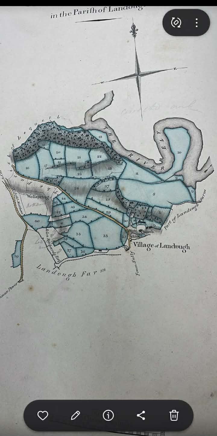
Quotation: “1824 map of Ty Mawr”
Proves: Repository holds an uploaded image titled “1824 map of Ty Mawr.”
Does not prove: Does not establish creator, scale, sheet, original custodian, actual map date, transcription, modern title, continuous possession, or match to later registered boundaries.
File stored in the wayback archive: EV-0004 in the artifact index.
Interpretation: working hypotheses
Working hypotheses, kept apart from the record above. The record text on this page is unchanged. None of these is a finding: each line is labelled as inference, theory, a reading that cuts against the case, or a discarded theory, and names the evidence it rests on and what would confirm or refute it, so the reader can test it. Updated 25 Oct 2026 (v2: ingredients wording).
The 1962 → 1974 → 1983 sequence
INFERENCE · I-04On the Ordnance Survey 1:2500 sheet revised 1969 (published 1971) the name appears as "Ty Mawr Farm", placed west of where the c.1900 and 1941 editions printed "Ty-mawr" (just east of the eastern farm range). This came a year before the 25 Jul 1972 outline permission and three years before the 1974 attempt to revive the 1962 order. The map change is record (E108); that it helped merge the house parcel and the fields in planning, enforcement and registration is the family's reading, not shown by any document.
Rests on: EV-0252 · EV-0046 · research log E101, E108
Would be confirmed by: Ordnance Survey revision papers or name-book entries showing who asked for the change and why.
Would be refuted by: Evidence the change was an ordinary OS revision with no outside request. Note: OS names do not define legal extent, and "Great House farm" appears in directories from 1887.
Status: Open (family hypothesis; map record found)
Cited on
4 pages link here.